

Thursday, February 16, 2017

Tuesday, August 2, 2016
Hazardous Fuels Treatments Pay Off!

Last Friday firefighters from Oregon Department of Forestry, US Forest Service, Sisters Camp Sherman Fire District, and Cloverdale Fire District responded to a fire located off of Wilt Road north of Sisters that is owned by Deschutes County. Prior fuel treatments in the area allowed for a successful coordinated multi-agency initial attack response to easily stop the fire at one acre. Due to the condition of the fuels, resources easily contained the fire and began mop-up even as temperatures reached 90 degrees and winds gusted at 10-15 miles per hour.
Approximately ten years ago
the property had small Ponderosa Pine, Juniper trees and brush removed,
considerably reducing the fire fuels available to burn. Typically the presence
of small trees (ladder fuels) and thick under brush make controlling a fire
under hot and dry conditions difficult for fire resources. With the fuels
reduction project, today the understory on this particular parcel is composed
of small scattered shrubs, bunchgrass and ponderosa pine. Not a single
tree torched in the fire area, the fire stayed on the ground and could easily
be controlled by firefighters arriving on scene with water and hand tools.
“Conditions are especially dry this fire season even with the wet winter
and spring we had this year, increasing the potential for fires to spread
quickly,” notes Ed Keith, Deschutes County Forester. “Fuel reduction projects
such as this allow for safer and more effective fire suppression,” explains Ed
Keith.
“Fires are a natural
occurrence here in Central Oregon, so everyone, including Deschutes County,
must take responsibility for their property to mitigate the potential losses to
themselves and their neighbors, “ adds Ed Keith. “Everyone,
from homeowners to firefighters and other community leaders have a role to play
in wildfire preparedness and better adapting to wildfire in Deschutes County,”
says Ed Keith.
“Fuels treatments on landscapes and defensible space projects greatly
reduce the impact that fires will have on the landscape and in neighborhoods
adjacent to those landscapes,” says Alison Green, Program Coordinator for
Project Wildfire. “Hazardous fuels treatments allow for safe and effective fire
suppression and a chance for communities to better understand their roles and
responsibilities when living in a fire prone environment such as central
Oregon,” she adds.
The outcome could have been
very different if the fire had occurred in the same area but where fuels had
not been reduced. This fire is added proof that years of coordinated fuel
reduction efforts by County, State, Federal and private landowners in Deschutes
County pay dividends in the form of providing a safer environment for
firefighters to work in while also providing safety to communities.
For more information about Project Wildfire visit www.projectwildfire.org. For more
information on Fire Adapted Communities fireadaptednetwork.org
Tuesday, May 31, 2016
Not Just Another Prescribed Burn
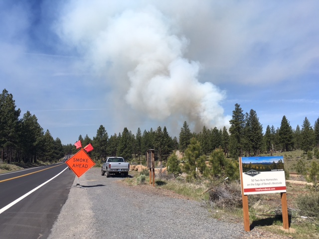
With the recent restoration activity near Phil's Trailhead the past spring many folks are getting used to seeing prescribed fire near Bend. But today's prescribed burn is so much more than that. This is the first project under a new participating agreement between The Deschutes National Forest, Bend Parks and Recreation District and the Tree Farm LLC. The agreement covers fuels reduction work on 700 acres of land within Shevlin Park, the Tree Farm neighborhood and adjacent national forest lands. The prescribed burning will reduce the impacts of a large fire on the City of Bend and improve forest health and wildlife habitat. It is expected that burning on the 700 acres will take two to three years to complete, with burns occurring primarily in the spring and late fall.
Forest Service personnel will conduct the burn, located on the western edge of Bend between Skyliner’s Road and Shevlin Park. In total 82 acres are planned for burning, ignitions began at 9:30 a.m. and will finish by 2 p.m. The prescribed burn is being done only on lands within the new Tree Farm neighborhood and no Forest Service or Shevlin Park lands are included in Tuesday’s burn.
This is a shining example of an all hands all lands approach to becoming fire adapted. The burn will increase the resiliency of the landscape and overall improve fire response.
Wednesday, May 25, 2016
Why didn't we all learn?
 |
Gutted homes and smoky streets in the Beacon Hill neighborhood of Fort McMurray.
TYLER HICKS/THE NEW YORK TIMES
|
As he stood on 12th Avenue with 35 homes and dozens of vehicles in flames around him, Lesser Slave Lake Regional Fire Chief Jamie Coutts was assaulted by a flood of thoughts.
One was that his team wasn’t trained to fight the kind of mega-fire that had roared out of the northeast Alberta forest in May, 2011, igniting parts of Slave Lake with a blizzard of embers that rained from the sky.
Another was “this happened in Kelowna in 2003, why didn’t we all learn from that?”
A great article on why living with fire is something we all need to consider when we choose beautiful landscapes such as central Oregon. Read the full article here: Why Didn't We All Learn?
Thursday, May 12, 2016
Preparing for Evacuation & Fire Season
As we enter fire season, the Sheriffs and Emergency Managers of Crook, Deschutes, and Jefferson counties and our partner agencies want to insure you understand the three level evacuation system and where to get current information regarding fire activity.

Level 1: Be Ready
There is an incident in your area and residents should be aware of potential evacuation. Be aware of the danger, monitor emergency services sources and local media for information. Those persons who will need additional time to exit an area or have health conditions (especially respiratory conditions that could be made worse by smoke) should consider leaving. You are encouraged to prepare or even move livestock and pets out of the area. Be prepared to leave if conditions worsen.
Level 2: Get Set
There is significant danger in your area and residents should be prepared to leave at a moment's notice. You are encouraged to leave and should do so as soon as possible. If you choose to stay, you should be able to leave immediately if conditions worsen. You MAY have time to gather necessary items, but doing so is at your own risk. Entry to evacuated areas may be denied until the hazard subsides.
This may be the only notice you receive. Emergency services cannot guarantee we will be able to notify you if conditions rapidly deteriorate.
Level 3: Go Now!
There is immediate and imminent danger and you should evacuate immediately. DO NOT delay leaving to gather any belongings or make efforts to protect your home. Leave immediately and as quickly as possible. Drive carefully, turn on your headlights, and follow any directions from emergency services personnel. Entry to evacuated areas will be denied until the hazard subsides.
Residents are encouraged to follow local media as well as the below sources of information to stay current on fire activity.
Current maps including evacuation areas in Deschutes County can be found at:
www.deschutes.org/emergency
For more information, you can visit the Central Oregon Fire Information site at:
http://centralorfireinfo.blogspot.com/
With this in mind, we urge you to take a look around your property in the "home ignition zone" where glowing embers can ignite spot fires and vulnerable areas like decks, patios and fences that can spread flames to your home. You can improve your home chance of survival by taking action before there's smoke on the horizon:
* Create defensible space around your home
* Are your gutters and roof valleys free from debris like pine needles and leaves? Clean them out. Despite a metal or asphalt shingle roof, the buildup of gutter debris provides necessary fuel for the glowing embers to ignite adjacent fascia boards or siding -- most often made of wood.
* Do your shrubs and weeds provide a path of fuel for fire to reach your trees or home? Reduce shrubs and other "ladder fuels" for at least 30 ft around your home to reduce the threat of ground fires igniting nearby trees, or your home.
* What can catch fire on your deck or patio or near your fence? Remove weeds, shrubs or any combustible materials from around, under or on top of your deck, patio or wood fence. This includes toys, planters, construction materials, patio furniture and cushions along with even small piles of pine needles or leaves.
* Is your woodpile near your home or other combustible vegetation? Move woodpiles at least 20 feet away from your home or other combustibles.
For more information go to: www.firefree.org
We further encourage you and your family to have a plan, get a kit, and stay informed regarding known or potential hazards in your area.
For more information go to: www.redcross.org
Or email questions to: SheriffPIO@deschutes.org

Level 1: Be Ready
There is an incident in your area and residents should be aware of potential evacuation. Be aware of the danger, monitor emergency services sources and local media for information. Those persons who will need additional time to exit an area or have health conditions (especially respiratory conditions that could be made worse by smoke) should consider leaving. You are encouraged to prepare or even move livestock and pets out of the area. Be prepared to leave if conditions worsen.
Level 2: Get Set
There is significant danger in your area and residents should be prepared to leave at a moment's notice. You are encouraged to leave and should do so as soon as possible. If you choose to stay, you should be able to leave immediately if conditions worsen. You MAY have time to gather necessary items, but doing so is at your own risk. Entry to evacuated areas may be denied until the hazard subsides.
This may be the only notice you receive. Emergency services cannot guarantee we will be able to notify you if conditions rapidly deteriorate.
Level 3: Go Now!
There is immediate and imminent danger and you should evacuate immediately. DO NOT delay leaving to gather any belongings or make efforts to protect your home. Leave immediately and as quickly as possible. Drive carefully, turn on your headlights, and follow any directions from emergency services personnel. Entry to evacuated areas will be denied until the hazard subsides.
Residents are encouraged to follow local media as well as the below sources of information to stay current on fire activity.
Current maps including evacuation areas in Deschutes County can be found at:
www.deschutes.org/emergency
For more information, you can visit the Central Oregon Fire Information site at:
http://centralorfireinfo.blogspot.com/
With this in mind, we urge you to take a look around your property in the "home ignition zone" where glowing embers can ignite spot fires and vulnerable areas like decks, patios and fences that can spread flames to your home. You can improve your home chance of survival by taking action before there's smoke on the horizon:
* Create defensible space around your home
* Are your gutters and roof valleys free from debris like pine needles and leaves? Clean them out. Despite a metal or asphalt shingle roof, the buildup of gutter debris provides necessary fuel for the glowing embers to ignite adjacent fascia boards or siding -- most often made of wood.
* Do your shrubs and weeds provide a path of fuel for fire to reach your trees or home? Reduce shrubs and other "ladder fuels" for at least 30 ft around your home to reduce the threat of ground fires igniting nearby trees, or your home.
* What can catch fire on your deck or patio or near your fence? Remove weeds, shrubs or any combustible materials from around, under or on top of your deck, patio or wood fence. This includes toys, planters, construction materials, patio furniture and cushions along with even small piles of pine needles or leaves.
* Is your woodpile near your home or other combustible vegetation? Move woodpiles at least 20 feet away from your home or other combustibles.
For more information go to: www.firefree.org
We further encourage you and your family to have a plan, get a kit, and stay informed regarding known or potential hazards in your area.
For more information go to: www.redcross.org
Or email questions to: SheriffPIO@deschutes.org
Thursday, March 31, 2016
More than Just another Fire Truck

Looking forward to part 2 & 3 for more learning and sharing
http://fireadaptednetwork.org/more-than-just-another-fire-truck/
Monday, March 14, 2016
Spring FireFree Dates
Please see the following dates for the Spring FireFree event coming up this May in all 4 counties in the central Oregon area. Please pass these dates along to interested parties.
Reduce the risk of losing your home to wildfire and take advantage of FREE yard debris disposal at local collection sites.
Create and maintain defensible space around your home and recycle your needles, branches, brush, shrubs and limbs for FREE!
Bend
Knott Landfill 7AM - 5PM
May 7 THROUGH 15, 2016
61050 SE 27th Street, Bend
Westside Collection Site 8AM-4PM
May 6-7 & 13-14, 2016
19755 SW Simpson Avenue, Bend (Between Century Drive & Mt. Washington on Simpson Ave.)
Redmond
Negus Transfer Station 8AM-4PM
May 20-21, 2016
2400 NE Maple Way, Redmond
Sisters
Northwest Transfer Station 8AM-4PM
May 20-21, 2016
68200 Fryrear Road, Cloverdale (Sisters)
La Pine
Southwest Transfer Station 8AM-4PM
May 20-21,2016
54580 Highway 97, La Pine
Sunriver
Sunriver Compost Site 8AM-4PM
May 13-14, 2016
Cottonwood Road, Sunriver
Madras
Box Canyon Transfer Station 8AM-4PM
April 30-May 1 & May 7-8, 2016
1778 NW Mill Street, Madras
Prineville
Crook County Landfill 8AM-4PM
April 23, 2016
110 SW Landfill Rd, Prineville
Crescent
Crescent Transfer Station 8AM-4PM
June 3-4, 2016
Crescent Cutoff Road, Crescent
Thursday, January 28, 2016
Preparing for After the Fire
 |
| Vimeo-After the Fire |
What a powerful video about how to prepare yourself for After the Fire. Defensible Space and home construction are two pieces of the puzzle. Preparing for the outcomes of large fires is the final piece in ensuring your and your neighbor's resiliency to large wildfires.
Monday, January 25, 2016
New Fire Adapted Communities Network Website

This new website has basic information about the FAC Learning Network, as well as Network resources and hundreds of blog posts related to community wildfire adaptation. We're especially excited about a new section that facilitates FAC practitioners connecting with their peers.
Some things you can do:
· Visit our member map and create a profile (for yourself and/or your organization) to join our online group of community wildfire resilience practitioners.· Follow us on Twitter and "Like Us" on Facebook .
· Subscribe to our blog and newsletter to receive updates and helpful resources right in your inbox.
· Check out our new Fire Adapted Communities Self-Assessment Tool (FAC SAT), created to help communities assess and track their level of adaptation, and create an action plan.
Wednesday, January 20, 2016
Wildfire Experts’ Paper Informs Effective Policy

For the full study click here: Headwater Economics
Friday, November 13, 2015
Love this video about defensible space. Your home CAN survive a wildfire!
With today and tomorrow being the last days of FireFree, take a moment to look at the small things around your home that could ignite your home in a wildfire event.
Tuesday, November 10, 2015
Only you...On Wildfire Today
 |
| Fire in the Lake San Antonio area of Monterey County, California, August, 2009. Photo by Vern Fisher. |
Only You...Smokey Bear does have it right
Such a interesting take on Smokey's tag line as it applies to our "new normal". This article highlights what it is to live in the wildland urban interface in a thoughtful way. My favorite quote "Living with fire is not an option for those who live in the Red Zone (WUI)." Check out the full story at the link below.http://wildfiretoday.com/2015/11/08/only-you/
Monday, October 12, 2015
3 homes destroyed in wildfire northeast of Boise
3 homes destroyed in wildfire northeast of Boise serve as a reminder that we are not yet out of fire season. Now is the time to prepare for the end of our current fire season and next summer with the upcoming FireFree events. For defensible space tips and the ten FireFree steps go to firefree.org


Thursday, October 1, 2015
City Edition
Thanks to our partners at the City of Bend for highlighting our federal partners. Great video on treatment in our local watershed.
Saturday, August 15, 2015
FIRE RESTRICTIONS INCREASE IN CENTRAL OREGON
ALL CAMPFIRES BANNED
Central Oregon – With dry conditions expected to continue in Central Oregon and fire suppression resources limited due to numerous wildfires in Oregon and Washington, the Prineville District Bureau of Land Management, the Deschutes National Forest and the Ochoco National Forest, including the Crooked River National Grassland, are implementing a total campfire restriction. Effective 12:01 a.m. August 18, 2015 (Tuesday), all open fires, including charcoal fires, will be prohibited on all lands administered by the Deschutes National Forest, the Ochoco National Forest and Crooked River National Grassland, and the Prineville District, BLM. There are no exceptions for developed or hosted campgrounds.
In addition to campfire restrictions, smoking remains restricted to an enclosed vehicle or building, in a designated campground, in boats on lakes and rivers, or while stopped in an area at least three feet in diameter that is clear of all flammable material. Portable cooking stoves or lanterns using liquefied or bottled fuel may still be used in all areas. Officials also want to remind the public that using explosive target material, such as Tannerite, explosives, and fireworks continue to be prohibited on all federal lands.
At this time there are no restrictions on motorized travel on BLM or FS roads in Central Oregon; however, fire officials want to remind visitors about the dangers of driving through or parking on vegetation. The hot undercarriage of a vehicle can easily ignite, not only burning the vehicle but also spreading to nearby vegetation. At this time, visitors are asked to avoid driving on two-track roads with vegetation down the center, and to park in areas clear of vegetation. Make sure vehicles carry a container of water or a fire extinguisher.
Before putting public use restrictions in place officials carefully consider the current fire situation, fuel moisture and predicted weather before making the decision to implement fire restrictions. Every year lightning-caused fires place a heavy demand on our firefighting resources, and put our wildlands, our firefighters, and our communities at risk. Fires caused through carelessness or negligence only increase the threat to life and livelihood, and place an even greater burden on already busy firefighters. Every fire that’s prevented protects our communities and helps our firefighters remain available, rested, and safe.
About the BLM: The BLM manages more than 245 million acres of public land, the most of any Federal agency. This land, known as the National System of Public Lands, is primarily located in 12 Western states, including Alaska. The BLM also administers 700 million acres of sub-surface mineral estate throughout the nation. The BLM's mission is to manage and conserve the public lands for the use and enjoyment of present and future generations under our mandate of multiple-use and sustained yield. In Fiscal Year 2014, the BLM generated $5.2 billion in receipts from public lands.
The mission of the USDA Forest Service is to sustain the health, diversity, and productivity of the Nation’s forests and grasslands to meet the needs of present and future generations. The Agency manages 193 million acres of public land, provides assistance to State and private landowners, and maintains the largest forestry research organization in the world. The USDA is an equal opportunity employer.
Friday, July 24, 2015
Fires approaching record nationwide
 |
| Flames from the Pine Fire burn in the back of trees on July 18, 2015, in Wrightwood, Calif. (Photo: David Pardo, AP) |
Wildfires have burned a phenomenal 5.5 million acres across the U.S. so far this year, an area equal to the size of New Jersey.
This is the second-highest total in at least the past 25 years, according to data from the National Interagency Fire Center in Boise. Only 2011, which saw 5.8 million acres charred as of July 23 of that year, had more. On average, at this point in the year, 3.5 million acres would have burned.
As of Thursday afternoon, 18 wildfires were burning in seven states, mostly in the West. This includes one in California's wine country that has forced numerous evacuations and is being fought by hundreds of firefighters, CALFIRE, the state's firefighting agency, reported. Another one is charring Glacier National Park in Montana.
Summertime heat and ongoing drought conditions have left vegetation starved of moisture throughout the West, making it more susceptible to catching fire and starting a massive blaze, AccuWeather reports.
Alaska has seen the worst of the fires: A large percentage of the acres burned — 4.7 million acres, or 85% of the total — have been in Alaska.
"Alaska has had an unusually active year based on low snow packs over the winter, and unusually hot, dry weather in May and June into July," fire center spokesman Randall Eardley said.
Indeed, Alaska has had a freakishly warm year, the state's second-warmest ever recorded, the National Centers for Environmental Information reported earlier this month. In June alone, wildfires charred nearly 2 million acres.
The El Niño climate pattern (warmer-than-average ocean water in the Pacific) is one of the driving factors in the furious wildfire season, especially in Alaska, said Wally Covington, a forest ecologist at Northern Arizona University in Flagstaff.
Overall, wildfires in Alaska appear to be worsening. Records on Alaska wildfires date all the way back to the late 1930s and show that three of the worst fire seasons have come in the last 12 years, including 2004, when more than 10,000 square miles — about 6.5 million acres, or the size of Delaware and Rhode Island combined — went up in flames, the Associated Press said.
In California, 12 of the state's 20 biggest fires on record have occurred since 2000, CAL FIRE said. Records there go back to 1932.
Covington said that there's been a clear link between man-made climate change and the increase in Western wildfires. "As air temperatures go up, and the fuels dry out faster, fire behavior increases. It's a double whammy," he said.
California's fire season also got off to an early start this year. The Golden State's fire season usually begins in late summer and goes into the fall, but several fires were reported even in the winter months, according to CAL FIRE. There have been more than 3,600 fires in California so far this year, almost 1,300 more than usual.
Subscribe to:
Posts (Atom)